(707) 839-5130 | Contact Us
Lacks Creek Road to Trail Conversion

Passing storm over Lacks Creek
Summary:
PWA developed a road-to-trail conversion plan to reduce future sediment delivery to Lacks Creek from the failing logging road network and supervised heavy equipment and labor operations required to convert the roads to trails.
Client:
PCFWWRA and Bureau of Land Management
Location:
Humboldt County, California Project Gallery:
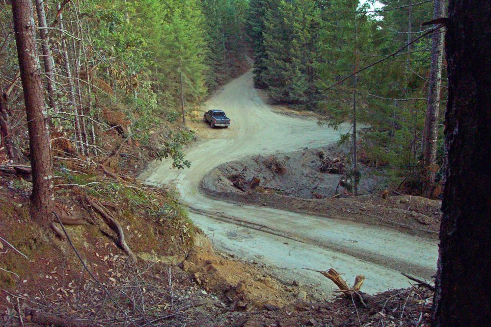
PWA was contracted by the Pacific Coast Fish, Wildlife and Wetlands Restoration Association (PCFWWRA) to develop and implement an erosion prevention treatment plan for eroding logging roads on Bureau of Land Management (BLM) lands in the Lacks Creek watershed, a tributary to Redwood Creek in northern Humboldt County, California. Lacks Creek is within the Congressionally authorized Park Protection Zone upstream from Redwood National Park. The primary focus of the plan involved reducing sediment delivery to Lacks Creek by: (1) converting selected abandoned, failing logging roads to a multi-use, public access trail system; (2) decommissioning high erosion risk roads that are no longer needed for land management purposes; and (3) upgrading (stormproofing) roads that will be required for emergency access, ecological restoration, and land management. Between 2008 and 2009 PWA supervised the treatment and conversion of approximately 24 miles of road, effectively reducing potential sediment delivery to Lacks Creek by an estimated 38,000 yd3.
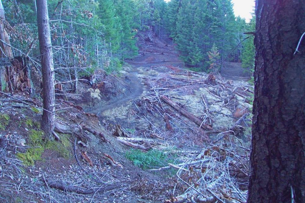
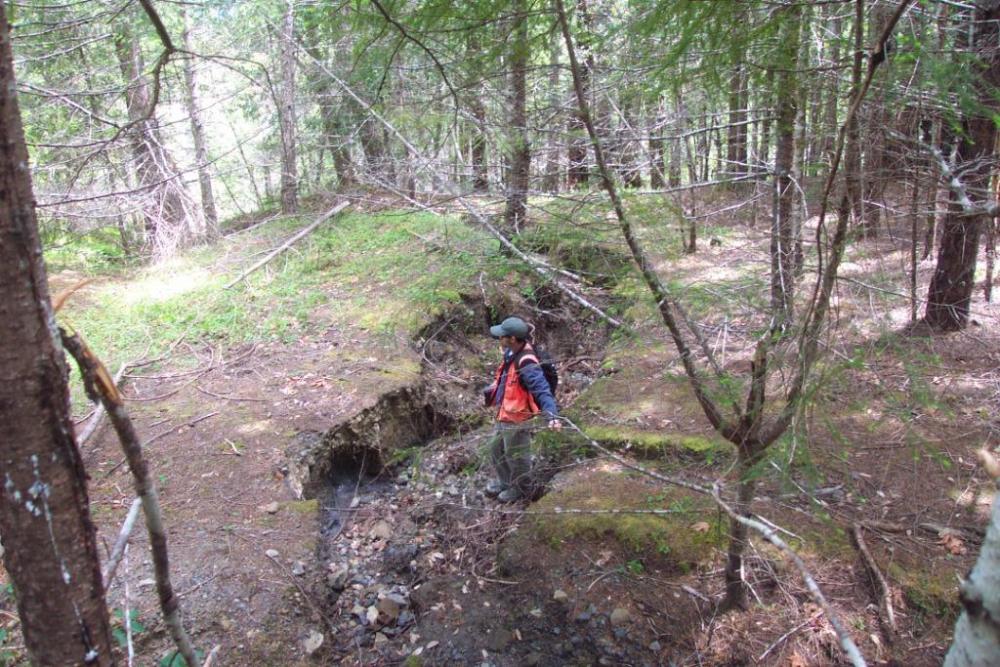
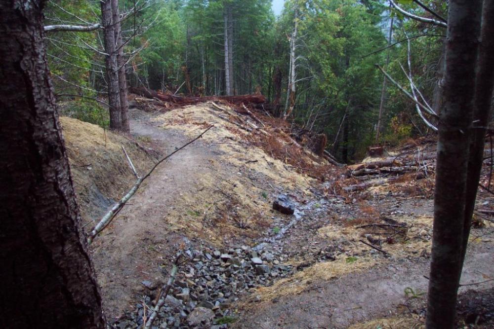
During the scope of this contract, PWA developed a road-to-trail conversion plan, which in addition to reducing future sediment delivery from the failing logging road network, allowed construction of a multi-use (pedestrian, bicycle, equestrian) public access trail system within the watershed. During implementation, PWA supervised all phases of heavy equipment and labor operations required to convert the roads to trails. This included excavating and relocating fill, organic debris, and deteriorating culverts at all stream crossings; excavating unstable sidecast fill at potential landslide sites; outsloping road reaches and installing rolling dips to improve dispersal of concentrated road surface runoff; stabilizing trail pathways with rock surfacing; and mulching disturbed ground to encourage revegetation and prevent possible interim erosion of bare soil surfaces. The final trail alignment, shaping, and surfacing was completed through the use of both heavy equipment and labor crews. This project is part of an on-going effort that is slated to continue until BLM’s watershed-wide management plan is completed. The associated cost of developing and implementing the erosion prevention treatment plan between 2008-2009 has been approximately $1,900,000.
Services Rendered :
- 7 of 26
- Projects:
- ‹ previous
- next ›
