(707) 839-5130 | Contact Us
GIS Capacity Development and Planning Support for the Trinidad Rancheria
Summary:
PWA provided GIS analysis and conducted trainings to support environmental planning efforts for the Trinidad Rancheria's Environmental Program.
Client:
Trinidad Rancheria
Location:
Trinidad, California Project Gallery:
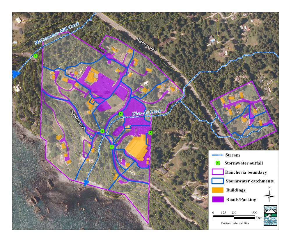
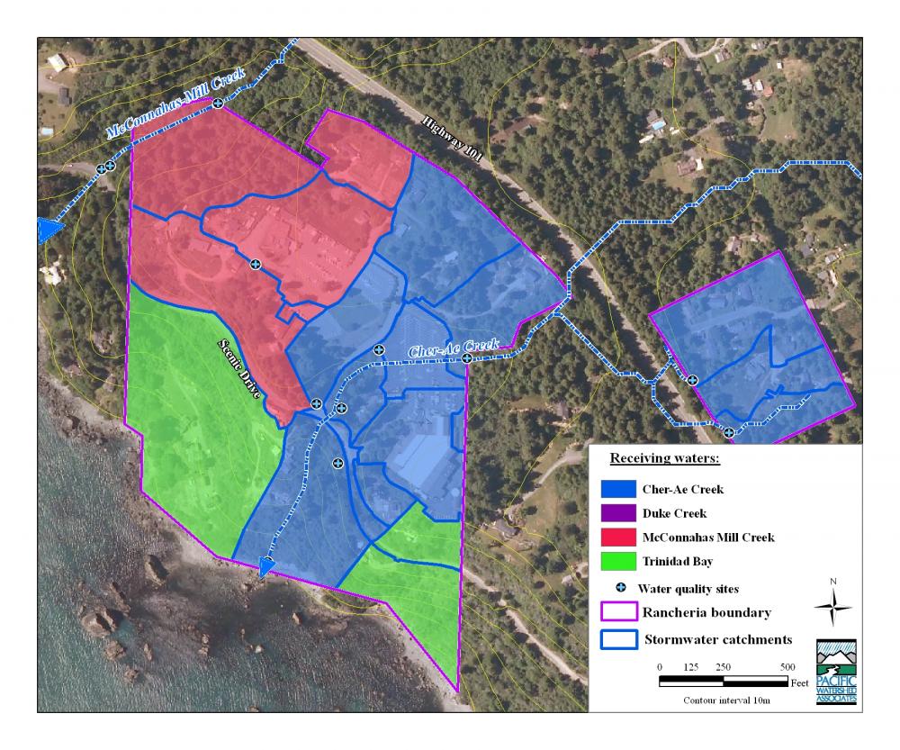
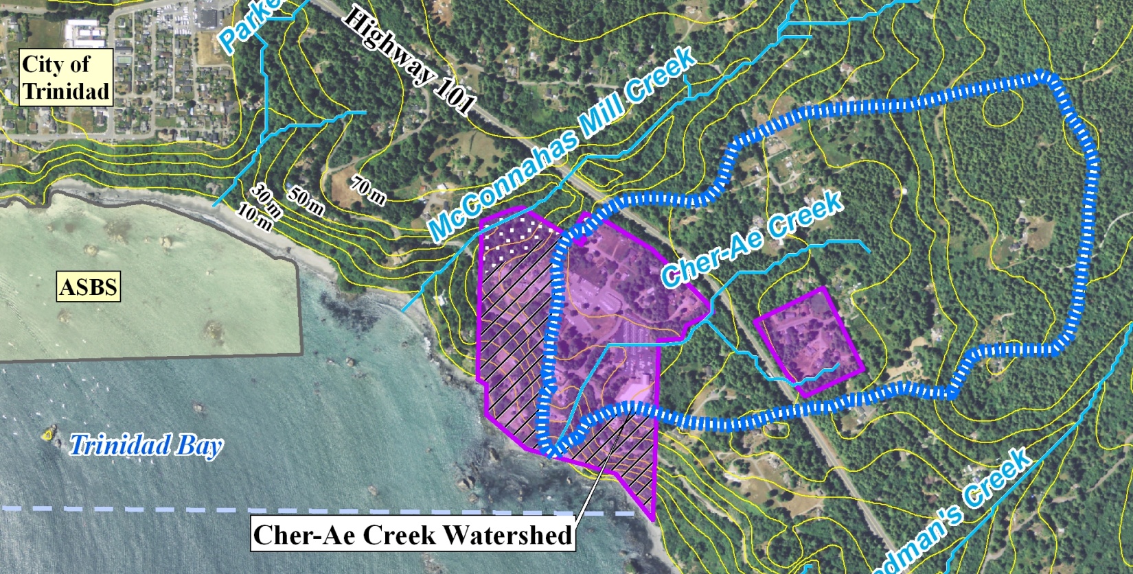
To support their federally funded water quality studies on Rancheria properties, the Trinidad Rancheria Environmental Program contracted Pacific Watershed Associates Inc. (PWA) to evaluate their current in-house GIS capabilities, develop a course of action for expanding their GIS capabilities, and complete a series of field investigations to evaluate stream geomorphology, stormwater discharge, erosion and sediment delivery, and onsite wastewater treatment systems on Trinidad Rancheria properties.
PWA conducted an evaluation of the current status of the Trinidad Rancheria’s existing GIS-related datasets, brought legacy shapefile datasets into visual alignment with geo-referenced imagery, and projected all datasets to a common spatial reference. We then worked with Rancheria staff to identify an array of public domain GIS data that could be used to support current and future management goals for the Environmental Program. In addition to installing a software upgrade (ArcGIS 9.3) on 3 separate Rancheria computers, PWA staff identified and acquired a suite of public domain datasets and associated metadata files appropriate for supporting natural resources, watershed, and water quality based management activities on tribal properties and adjacent land. Technical trainings were then conducted with Rancheria staff to improve their ability to utilize GIS as planning tool.
Due to the lack of existing baseline data characterizing environmental conditions, stormwater and wastewater infrastructure within the Rancheria's landholdings, PWA conducted a series of field investigations to identify potential sources of erosion and sediment delivery, stormwater runoff and contributing drainage areas, and onsite wastewater treatment systems for both residential and commercial properties. We then developed GIS datasets from our field-based assessments that are currently being used to support water quality analysis, prioritize low impact development retrofit projects, develop culvert sizing recommendations, and other planning efforts to support environmental management throughout the Rancheria's landholdings.
Services Rendered :
- 6 of 26
- Projects:
- ‹ previous
- next ›
